
Where we work
We are drainage engineers and civil engineering designers working across Gloucestershire. We have delivered 41 projects here: drainage strategies, SuDS reports, flood risk assessments and highway design, prepared for planning and taken through to approval.
You do not need a consultant down the road from your site. This is desk work built on survey data, ground testing and the local authority’s own standards. What matters is that whoever does it knows what Gloucestershire County Council asks for, and what the ground in Gloucestershire will actually do.
Our projects in Gloucestershire, in red, against the rest of England. One dot per project, placed within its postcode area rather than at the exact site. Zoom out for the full picture, or ctrl and scroll to zoom.
Civil engineering design in Gloucestershire
- Drainage design in Gloucestershire: surface water and foul drainage strategies, attenuation, SuDS and outfall design, sized for your site and your discharge rate.
- Flood risk assessments: site-specific flood risk assessments for sites in Flood Zones 2 and 3, and for sites over a hectare in Zone 1.
- SuDS design: sustainable drainage design and the SuDS statement your planning authority expects, with the drainage hierarchy worked through in order.
- Highway design: access, visibility splays, turning heads and adoptable road design, including Section 38 and Section 278 agreements.
- Percolation testing: BRE 365 soakaway testing across Gloucestershire, arranged through PT (West Midlands) Ltd so the design and the testing come from one place.
Ground conditions in Gloucestershire
Gloucestershire splits cleanly in two. The Cotswolds are Jurassic oolitic limestone, which is permeable and often takes infiltration well. Below the escarpment the Lias clays, muds and silts take over into the Severn Vale, and those have close to no percolation capacity: the same formation responsible for the landslips along the escarpment itself.
None of that tells us what is under your plot, and no report should pretend otherwise. It tells us what to expect, what to test for, and whether to plan for infiltration or for attenuation and a restricted discharge. A percolation test to BRE 365 settles it, and it is cheaper to do that before the design than to redesign afterwards.
Source: Cotswolds National Landscape, geology. Requirements and ground conditions both change: we check them at the start of every job.
The drainage hierarchy
- 1InfiltrationSoakaway or infiltration basin, if the ground takes it
- 2WatercourseDischarge to a surface water body, usually rate-restricted
- 3Surface water sewerWhere a public surface water sewer exists and has capacity
- 4Combined sewerLast resort, and increasingly refused outright
Every scheme has to work down this list in order, and show why each option above the chosen one was ruled out. The ground is what decides whether you get to stop at step one.
Gloucestershire at a glance
- Lead local flood authority
- Gloucestershire County Council
- Postcode areas
- GL
- Projects delivered here
- 41
- Statutory consultee
- Yes, on surface water for major development
- Percolation testing
- BRE 365, via PT (West Midlands) Ltd
- Case studies
- 6
What Gloucestershire County Council expects
Gloucestershire expects surface water to be attenuated to at least the greenfield runoff rate, and to achieve betterment where possible. On a previously developed site that means improving on the existing rate rather than simply matching it, which usually drives the storage volume.
The county council is the lead local flood authority and has been a statutory consultee on all major development since 2015; the district councils determine the applications. Their Local Development Guide sets out what they expect to see.
Source: Gloucestershire County Council. Requirements and ground conditions both change: we check them at the start of every job.
Flood risk assessments in Gloucestershire
Drainage is the bulk of what we do, but in Gloucestershire a large share of it comes with flood risk assessment attached, because the Severn Vale puts a large share of its development land in Flood Zones 2 and 3.
A site-specific flood risk assessment applies the sequential and exception tests, works out the flood levels your site will actually see over its lifetime including an allowance for climate change, and sets finished floor levels, safe access and egress against them. Gloucestershire County Council and the Environment Agency both look at it, and the commonest reason one comes back is that it assessed fluvial risk and ignored surface water.
We do this as part of the same job, so the flood risk assessment and the drainage strategy agree with each other rather than being written by two firms who never spoke. More on flood risk assessment.

What you need, and when
The work is not one document handed in once. It arrives in stages, and sending the wrong level of detail at the wrong stage is one of the commonest reasons an application stalls with Gloucestershire County Council.
- Outline application. A strategy showing the principle: where the water goes, roughly what it will take, and that the site can be drained at all. Detailed calculations are not expected yet, but a strategy that ignores the discharge hierarchy will be questioned.
- Full application. The full surface water and foul scheme with calculations, layout, attenuation volumes and the discharge rate you are asking for, evidenced.
- Reserved matters. The detail that was reserved at outline, now built out against the approved strategy, and it has to match it.
- Discharge of conditions. The final submission against the wording of the condition itself, with the maintenance and management arrangements Gloucestershire County Council asks for. This is the stage most people reach us at, often with a condition already imposed.
Where the work lands
- OutlineDrainage strategy: the principle, not the detail
- FullFull scheme, with calculations and discharge rate
- Reserved mattersThe detail, matching the approved strategy
- DischargeSubmission against the condition wording itself
Most people reach us at the last step, with a condition already imposed. That is fine: it is just cheaper to have got the strategy right at the first.
Typical conditions we discharge in Gloucestershire
Exact wording varies between officers and between applications, but conditions on sites here almost always fall into three shapes:
- Surface water drainage. “No development shall commence until a detailed surface water drainage scheme, based on sustainable drainage principles and an assessment of the hydrological and hydrogeological context of the development, has been submitted to and approved in writing by the Local Planning Authority.” This is the one that needs the percolation results and the attenuation calculations.
- Foul drainage. A scheme for foul water disposal, agreed before occupation, straightforward on a mains connection, considerably less so on a package treatment plant or where the sewer is at capacity.
- Management and maintenance. A plan setting out who maintains the drainage for the lifetime of the development, and how. Often overlooked, and a common reason a discharge application comes back.
If you have a condition in front of you, send us the wording. We will tell you what it actually requires, before you commit to anything. There is a fuller guide to drainage planning conditions if you want to read up first.
Our work in Gloucestershire
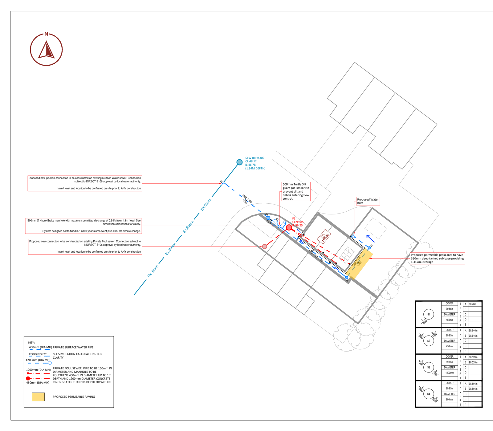
Past project locations here include Gloucestershire, Gloucester, Lydney Football Club, Cirencester, Elmleaze and Longhope.
- A single dwelling in Gloucester
- Mobile homes in Gloucestershire
- An extension in Cheltenham, Gloucestershire
- An extension in Lydney
- A single dwelling in Wigpool
- An extension in Gloucestershire
Questions we get asked in Gloucestershire
Do you need to be local to do this work?
No. It is done from survey data, ground investigation and Gloucestershire County Council’s own standards, none of which require us to be nearby. Being the right distance from your site has never discharged a condition; knowing what the authority wants has.
Who is the lead local flood authority for my site?
Gloucestershire County Council. They are a statutory consultee on surface water drainage for major development, and they set the local standards and the discharge rate your scheme is judged against.
Do I definitely need a flood risk assessment?
If your site is in Flood Zone 2 or 3, or is over a hectare in Zone 1, yes. Smaller sites in Zone 1 can still need one where there is a record of surface water flooding, and in Gloucestershire there often is. Send us the address and we will check the maps before you pay for anything.
Can a flood risk assessment get a refusal overturned?
Sometimes. An FRA that applies the sequential and exception tests properly, and shows safe access, egress and finished floor levels, can answer the objection that caused the refusal. It depends entirely on why it was refused.
What holds a drainage scheme up?
Usually the ground testing, and where one is needed, the response time from Gloucestershire County Council or the water company: not the design itself. Getting the testing booked early is the single biggest thing you can do to keep a scheme moving.
I already have a planning condition. Can you deal with it?
Yes, and it is most of what we do. Send us the condition wording and the site address and we will tell you what is needed to discharge it.
Get a quote for your Gloucestershire site
Send us the site address and the condition wording, or the planning reference, and we will tell you exactly what is needed. If you do not need us, we will say so.